Encyclopedia Dubuque
"Encyclopedia Dubuque is the online authority for all things Dubuque, written by the people who know the city best.”
Marshall Cohen—researcher and producer, CNN
Affiliated with the Local History Network of the State Historical Society of Iowa, and the Iowa Museum Association.
MILITARY ROAD
MILITARY ROAD. Route between Dubuque and Iowa City planned for the quick movement of mail and troops. The idea for the road was delivered to Congress by W. W. Chapman, a delegate from Iowa Territory in 1826. Presented as a resolution, Chapman's proposal called for a road from Dubuque to Missouri by way of as many county seats as possible. The path of the road was planned to pass through Dubuque, Jones, Linn, Johnson, Washington, Henry, and Van Buren counties in Iowa before reaching the Missouri border.
Congress approved the concept. President Van Buren signed the bill in March 1839, authorizing Iowa's first military road and twenty thousand dollars for surveying the location. R. C. Tilghman, a Baltimore, Maryland, surveyor and engineer, was given the job of surveying the route, but a question remains how the road was completed.
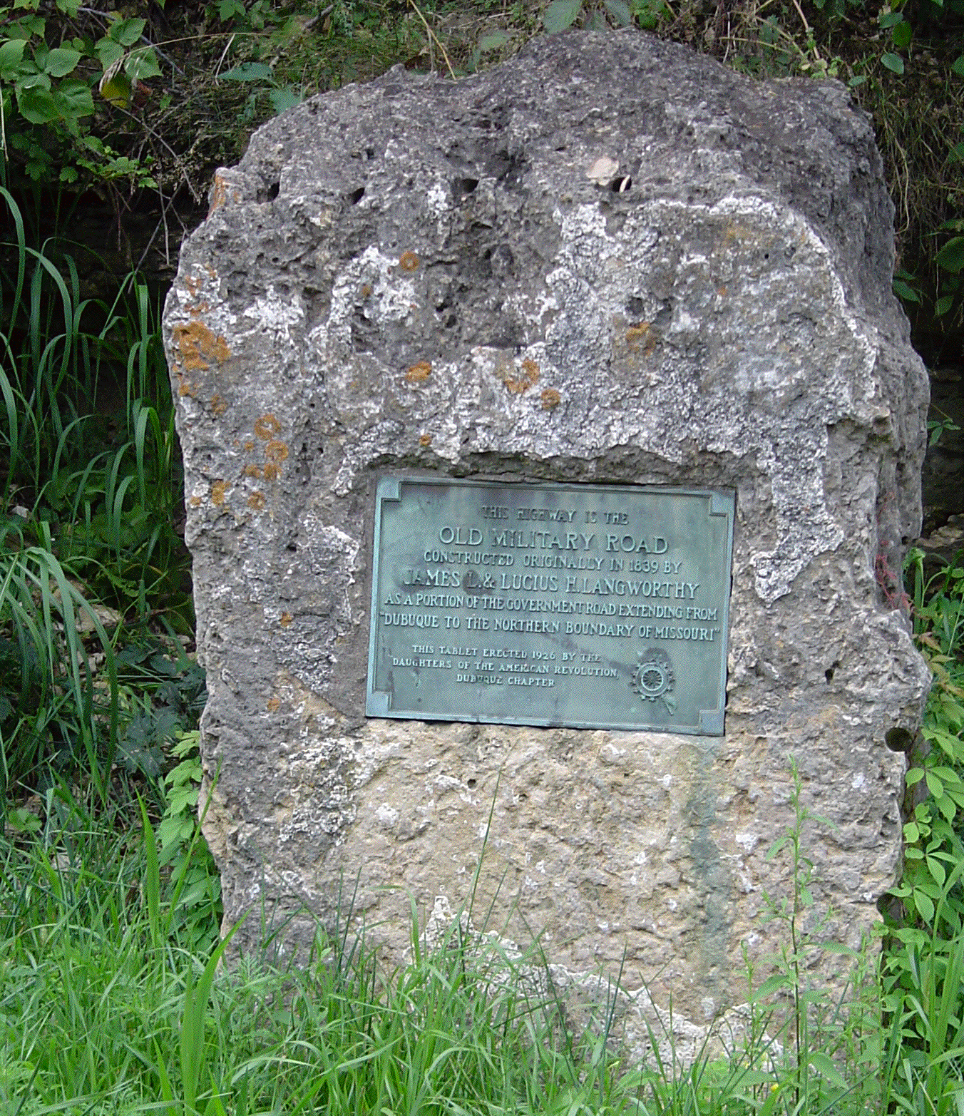
One account states that Tilghman employed Lyman DILLON of Cascade to plow a furrow from Dubuque to Iowa City as a guide for the road builders. The bronze plaque erected southwest of Key West along the Military Road states: "This Highway is The Old Military Road constructed originally in 1839 by James L. and Lucius Hart LANGWORTHY as a portion of the Government Road extending from Dubuque to the Northern Boundary of Missouri."
Controversy also exists as to what extent the route was plowed. The official map on record in the National Archives in Washington, D.C. indicates the route stretched from Dubuque to Cascade, then northwest of Anamosa and Monticello, southeast of Martelle, and east of Solon. Whether Dillon followed this path may be questioned when driving through the area and viewing the rugged terrain.
The erection of the monument marking the path of the Military Road near Dubuque was attended by an estimated two hundred Dubuque residents. The tablet was a gift of James Currie COLLIER, a Langworthy relative. The committee responsible for placing the plaque and the dedication program consisted of Mrs. Mary Langworthy Bunting, Mrs. J. J. Roshek, and Mrs. G. D. Rose. Miss Susan Valeria Altman, a great-great granddaughter of the late Lucius Langworthy, and Massey Harris, another Langworthy relative unveiled the marker.
The exact path of the route is less important than what it accomplished. While seldom used by federal troops, the pathway was used by caravans of pioneers headed for California. The payment of twenty thousand dollars by Congress also marked an important first-time commitment to the Iowa Territory and encouragement for settlers to stay in this new land. Today Highways 151 and 1 mark the approximate location of the road.


