Encyclopedia Dubuque
"Encyclopedia Dubuque is the online authority for all things Dubuque, written by the people who know the city best.”
Marshall Cohen—researcher and producer, CNN
Affiliated with the Local History Network of the State Historical Society of Iowa, and the Iowa Museum Association.
SWISS VALLEY: Difference between revisions
No edit summary |
No edit summary |
||
| Line 1: | Line 1: | ||
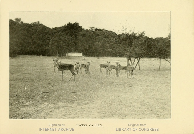
SWISS VALLEY. Located south of Dubuque, Swiss Valley was a farming area in pioneer days. Its steep hills and fertile valley reminded residents from Switzerland of their native land and so the area was named. | [[Image:HB5.png|left|thumb|250px|Photo courtesy: '''Dubuque and Its Neighborhoods''', Harber and Blish, 1897]]SWISS VALLEY. Located south of Dubuque, Swiss Valley was a farming area in pioneer days. Its steep hills and fertile valley reminded residents from Switzerland of their native land and so the area was named. | ||
A man named Googleman staked out, but did not live long enough, to record the location of a mining claim in the area. His farm was purchased by two families, the Baehlers and the Quades. The private cemetery of the Quades could be seen in 2015 along the northern side of Swiss Valley Road. | A man named Googleman staked out, but did not live long enough, to record the location of a mining claim in the area. His farm was purchased by two families, the Baehlers and the Quades. The private cemetery of the Quades could be seen in 2015 along the northern side of Swiss Valley Road. | ||
Revision as of 03:35, 21 September 2018
SWISS VALLEY. Located south of Dubuque, Swiss Valley was a farming area in pioneer days. Its steep hills and fertile valley reminded residents from Switzerland of their native land and so the area was named.
A man named Googleman staked out, but did not live long enough, to record the location of a mining claim in the area. His farm was purchased by two families, the Baehlers and the Quades. The private cemetery of the Quades could be seen in 2015 along the northern side of Swiss Valley Road.
In 1839 a grist mill was established by Glade and Etting upstream from the Baehler farm located near the modern entrance to Swiss Valley Park. Fred Baehler married Caroline Quade so all the residents in the valley were related.
On July 4, 1876 water from a large rainstorm collected in the valley and began its way toward Rockdale causing a great flood with loss of life. A Confederate spy named John Beall attempted to hide in Swiss Valley during the CIVIL WAR, but was reported by a local farmer and caught. Tried by a military court, he was executed by firing squad. During PROHIBITION an illegal still was operated on the Baehler farm. Upstream from the cabin was a water-drive mill near the later location of the nature center. On the only road to the mill was a brothel.
---
Source:
Barker, Richard A. Dubuque's Haunted History, Boulder, Colorado: Trails Books, 2011, p. 152


